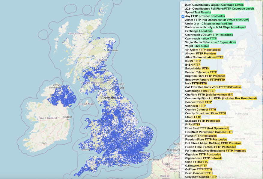
Interested in commercial use of our data?    We offer APIs and bulk access to data — For more information see our Commercial Data page

Gigabit Broadband Coverage

(based on availability of 900 Mbps or faster fixed line services)

Click a nation on the map to browse detail for its councils and constituencies

UK Broadband Map

Map showing where the many full fibre and wireless services are available.

Also view various postcode speeed overlays and a summary map of constituency level superfast coverage and speeds.

Postcode Area Technology Performance Map

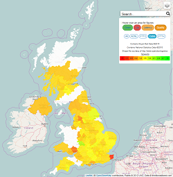
Speeds, latency and quality measurements by postcode letter group

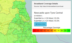
Data for ADSL, FTTC/VDSL2, cable, FTTH and all technologies combined.

Ultrafast G.fast deployment scenario

Openreach is planning 10 million G.fast premises this map shows which areas we think might be enabled.